SURFACE GEOPHYSICAL INVESTIGATION (RESISTIVITY SURVEY)

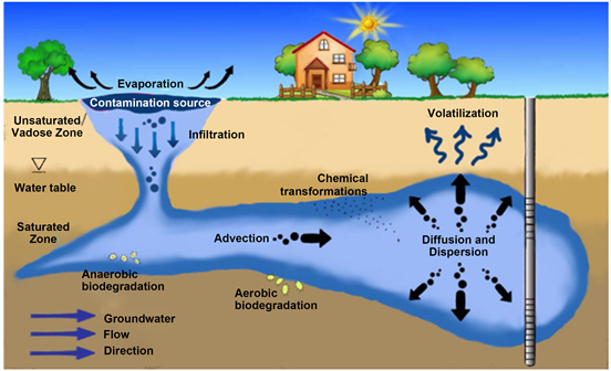
The company is equipped with latest deep penetration, generator operated, Micro Processor based, Signal Stacking A.C. Resistivity Meter & D.C. Resistivity Meter which can investigate ground water conditions, probable strata and ground water quality down to 400 m respectively. The study is useful in pin pointing sites for water wells and drilling of boreholes. Battery operated Resistivity Meter is also available with the firm to study the disposition and interstitial quality of aquifers upto 150 m and soil resistivity investigation. The Resistivity surveys have been used for locating deeper aquifers (water bearing zones) in hilly terrain, intermountain valleys, hard rocks, Kandi areas and deep-seated aquifers. The equipments are digital with computer aided facility for field data analysis. Apparent resistivity data analysis yielded highly encouraging results in pin-pointing sites for construction of tubewells and ground water structures(percolation wells, infiltration galleries etc.). The equipments have effectively been used by the company in solving problems like locating potential water bearing zones at deeper levels, demarcation of fresh / saline water interface, saline aquifers, delineation of ground water pollution areas and identification of type of the rig to be deployed. The company has conducted more than 10,000 vertical electrical soundings in the States of Punjab, Haryana, Himachal Pradesh, Uttarakhand, U.P., J & K, Rajasthan, Madhya Pradesh and Delhi.
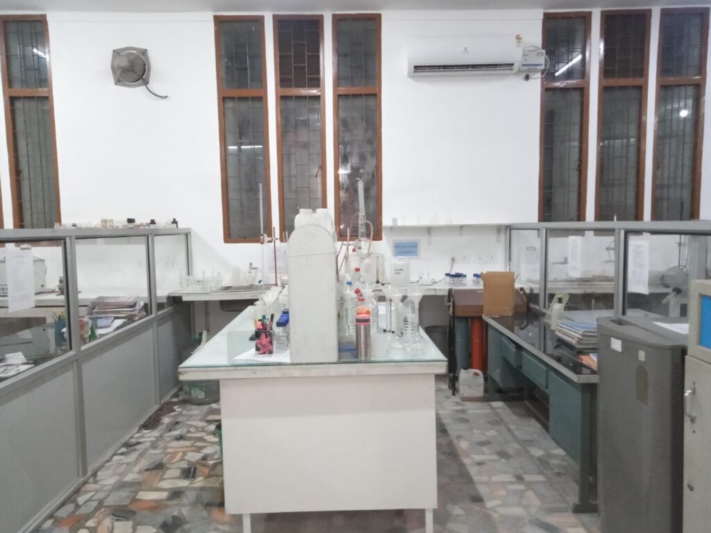
BOREHOLE LOGGING

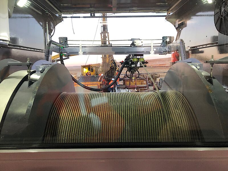
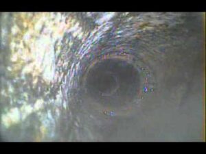
The company has a digital and analog Electronic Well Logger of 600 m capacity indigeneously developed by Uptron and is mounted in a Vehicles. Highly experienced hydrogeologist of the company operates the logger, prepares the recommendation for design of wells. The logs are utilized for strata identification, assessment interstitial quality of formation water and designing well assembly. The parameters recorded are formation Resistivity (point resistance,16” short normal , 64” long normal, lateral, Self Potential. Drilling Fluid Conductivity. These are used for precise demarcation of aquifers (water bearing zones) encountered in the boreholes, establish aquifer geometry and find out water quality. A preliminary idea of the aquifer parameters is also made with the help of these logs. The logs are interpreted manually at the drilling sites and also with the help of advanced computer software packages in the office. The company has logged more than 15000 boreholes in different states. The company also has provision of Gamma borehole logging. The logging helps in demarcation of mixed zones & clear horizons of Sand-Boulder. The benefit of Gamma logging is that it can be conducted in cased as well as uncased boreholes & also in case of borehole drilled by percussion rig in which 3-4 casings of M.S. pipes are used.

Our Services

WATER WELL BOREHOLE CAMERA


Applications

Borehole camera is a complete miniature inspection system. Downhole conditions are too complex to predict and estimate with accuracy. To pinpoint the problem such as damaged casing or screens, obstruction, break, corrosion, punctures, encrustations, location of lost pumps or tools and also viewing sources of contamination by assessing the presence of color, turbidity, algae etc. along the screen lengths. In a nut shell borehole camera would give a clear picture for ‘fishing’ technique to be implemented for rejuvenate the sick production tubewell.  


Why water well Geo-Scanning System

In production tubewell or in any tubewell filled with clear water, prime use of borehole camera includes the investigation of casing/ slotted pipes conditions  such as holes, location of fractures,  boreholes environment etc. A periodic monitoring of large number of production wells generally conducted in water supply department, managed either by Municipal Corporation or governments, will increase the life of the well.


Damaged casings or Screens

The frequent sickness of the tube wells in the alluvial area (sand, gravels and boulder etc) are mainly due to damaged casings or screens. The major problems do occur at the welding joints, screen open area and reducer which results in sand pumping, lowering of yield and contamination. Sometimes the casing is punctured due to lowering of the pumps, high encrustation and dropping of tools. The modern water well scanning system is essentially applied to assess the extent of damage.


Encrustation

A large number of tubewell in alluvial area are prone to reduction in discharge due to deposition of inorganic salts mainly soluble CaCo3 present in ground water on tube wells screen. When the well is under pumping, the hydrostatic pressure in the water bearing formation decreases. This reduction in pressure increases the pH and enhances the ground water equilibrium to shift towards the precipitation of calcium carbonate in well water resulting in incrustation. This results in clogging of screen openings and aquifer around (water bearing zone) the screen. Thus reducing the opening area, which ultimately leads to reduction in well efficiency and its yield over years of operation.Borehole camera is applied on such pumping wells to locate the incrustation in the well screens to vervitalize

Obstructions in well


Obstruction, in general, caused in the tubewells operating in alluvial areas by rupturing of screens due to pressure variations compaction of overburden and even sometimes by roots wedging. This  type of obstructions cause some malfunctions in the operations of well. The borehole camera helps in indentifying such defects so that proper planning or rehabilitation of the well can be done.


Well Screen Inspection

The corrosion, punctures, the integrity of the tubewell and similar problems associated with tubewell screens and gravel pack are common problems in the production wells. In particular the borehole camera is applied to investigate the problem present in the tubewell.


Intergrity of well

Early detection of potential problems saves money, time and even the well. Borehole camera helps in viewing the integrity of the well, which gives the picture of the health of well.


Geological inspection (Hard Rock Area)

Bore hole camera used to view the rock lithology of the borehole wells indentify the contact zone, type of formation, nature of formation seepages and water falling in the well.


Viewing Sources of Contamination

Due to release of effluent by industries, generally the groundwater in the vicinity is likely to be contaminated. Borehole camera logging can be conducted to identify the source entry points within the well by assessing the presence of colour, turbidity, algae etc. along the screen lengths. The qualitative interpretation of such log demarcates the disposition of contaminated aquifer system. The remedial measures can be done by sealing of entry source points within the well.


Rehabilitation of old wells

At Sites where the original constructional details of a tubewell are unknown borehole Camera system is used to locate casing, diameter changes and even entry passage of water.


Locating lost pumps or tools


Accidents like dropping of the pumps, column pipes, and tools do occur in the course of maintaining the production water well. The Borehole Camera would give a clear picture for proper “fishing” technique to be organized for recovery of equipment. 

WATER WELL DRILLING AND DEVELOPMENT 


The company is backed with Hi- Tech drilling units having heavy duty Reverse Rotary Rigs that can drill boreholes and construct deep tubewells down to 500 m. The company is also having Direct Rotary Rigs, capable of drilling boreholes and construct tubewells down to 250 m in bouldery areas and 600 m in soft alluvial formations. The tubewells are developed with high capacity compressors to obtain optimum discharge. To develop the deep tubewells at higher discharge the company is in possession of high discharge submersible pumps of different heads. The company has the distinct capability of deep drilling in Kandi /Bhabar (integrated alluvial fans), bouldery, alluvial and semi-consolidated formations. The company has drilled more than 800 wells in the different Sates in different geological formations.


LOWERING OF WATER LEVELS FOR LAYING FOUNDATIONS


 At some of the places where shallow ground water or perched water level occurs and foundations are to be laid below water level for construction of building, in such areas it becomes difficult to lay the foundations. Under these circumstances, the company is capable of designing and construction of net work of wells which can lower and maintained the water level at the desired depth for the period till construction is carried out. The company has taken up this type of work for number of projects.


TREATMENT TO SICK WELLS 

Generally the yield of the tubewell is reduced by chemical and biological encrustation of the well screens and the formation materials around the intake portion of the well. Environ Tech Labs under take the job of well rehabilitation of sick tubewells by restoring well yield to its most efficient condition. The sick wells are given various chemical treatments depending on the type of encrustation which often forms hard brittle, cement like deposit. Generally following type of encrustation are observed:


1)   Precipitation of calcium and magnesium carbonates/ sulphates.

2)   Precipitation of iron and manganese compounds primarily their hydroxides or hydrated oxides.

3)   Plugging caused by slime producing iron bacteria or other slime forming organisms (biofouling).


Depending upon  nature of deposition / encrustation best suited treatment is given to the well. The disinfection of tubewells/water storage tanks is also taken up effectively and safely. 


GROUND WATER POLLUTION STUDIES 


 The labs have equipments and expertise for under taking sampling and analysis of inorganic constituents, heavy metals, organic contaminants (BOD, COD & TOC) , bacteriological tests (total coliforms, faecal coliform, faecal streptococci and E-Coli)and ambient air tests. Ground water pollution studies have been taken up and lateral / vertical extent of ground water pollution identified for many industrial units.


GROUND WATER INVESTIGATIONS 

The company is well equipped for taking up all problems related to ground water, its assessment & sustainability, water level behavior of the area, identifying the approach for ground water exploitation suited for the area and type of drilling rig required. Company has the capability to undertake regional / micro level ground water studies. The company also takes up ground water studies for preparation and submission of geneises report to the Bureau of Indian Standards for natural mineral water and packaged drinking water plants. 


  1. PUMPING TEST

Evaluation of the aquifer parameters like Transmissivity, storage coefficient, lateral hydraulic conductivity and specific yield is very essential in assessing ground water potential of an area and aquifer system. Pumping tests are carried out for this purpose on each well drilled by the company after the well is fully developed. While conducting pumping tests, water levels are monitored in the tubewell in order to study the response of pumping on the water level. Where required piezometers are constructed along with the test well (tubewell) for monitoring the water levels. Various software packages are available with the company for processing and analysing pumping test data for different aquifer dispositions.

RAIN WATER HARVESTING


Almost all cities are facing shortfall of water supply and water levels are declining at a fast rate. This is because the rainwater is not conserved and is allowed to drain away. To meet increasing demand of water in urban areas, the rainwater harvesting should be taken up on large scale. It can be harvest by collecting rainfall from the building roof tops, paved areas, runoff of nalas, khads & choes by adopting appropriate approach. In hilly areas, the rainwater can be harvested by constructing low dams. The preparation of feasibility report, designing of structures, working out estimates and construction of all type of rain water harvesting works are also taken up.

ARTIFICIAL RECHARGE TO GROUND WATER


With the increase in demand of water there is more stress on pumping of ground water. As surface water is not available in adequate quantity so number of ground water structures are increasing every year in all cities and rural areas, which has resulted in lowering of water levels drastically. In some areas the rate of decline of water levels is more than one metre per year. The only method to check the lowering of water level is to recharge the depleted aquifers. We undertake preparation of feasibility reports, construction of recharge structures and related civil works.

  1.  

  2.  

CLEARANCE OF PROJECTS FROM PUNJAB WATER REGULATION & DEVELOPMENT AUTORITY AND HARYANA WATER AUTHORITY


Hydrogeological surveys are carried out for clearance of industrial units and obtaining N.O.C. from the Authority. We prepare Impact Assessment on ground water report for submitting to the Authority.